This and many other uses including aerial filming, can be achieved at minimal cost but maximum quality, efficiency and accuracy and all to a tight deadline.
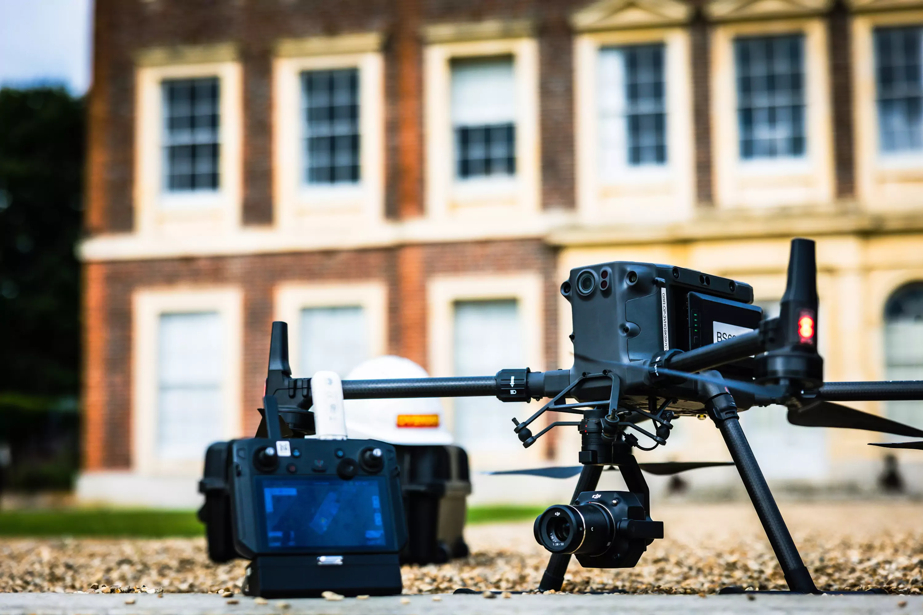
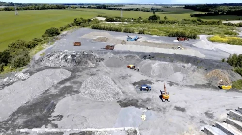
Whilst we have access to various drone technologies our flagship is our DJI 300 Matrice RTK platform, the new cutting edge tool from Ovenden Drone Services.

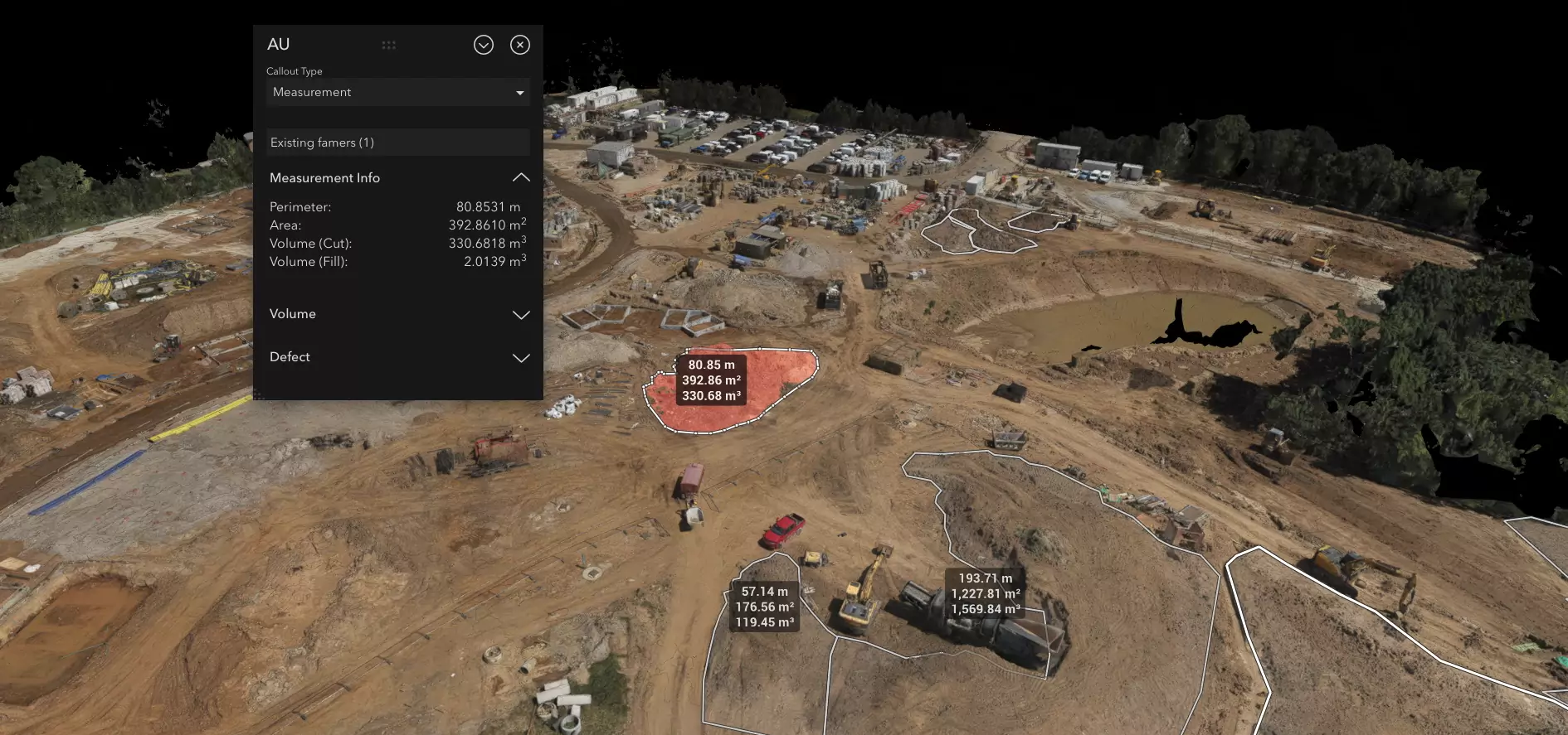
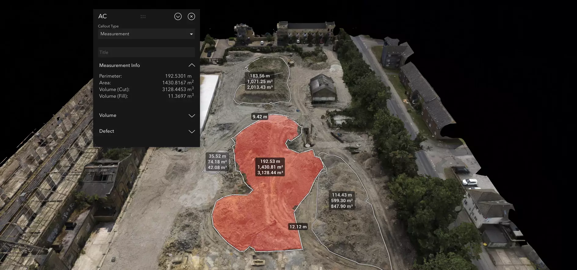
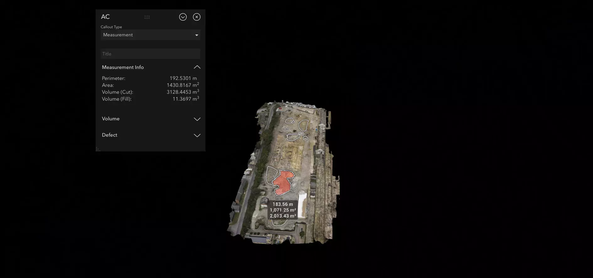
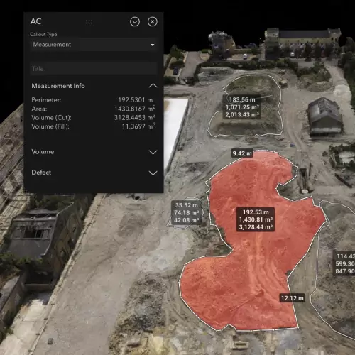
Our DJI Matrice 300 RTK is ideal for surveying, mapping and volumetric operations and has the ability to capture high-quality images and data from a multitude of angles, making it ideal for a range of applications.
The Matrice 300 RTK also offers enhanced precision, accuracy and the opportunity to view data in real-time either on site or streamed, being especially beneficial for such projects as inspections.
The Matrice 300 has a Real-Time Kinematic (RTK) system, which allows it to achieve centimetre-level accuracy unlike traditional methods with limits in excess of one metre.